Simpsons Gap Sunset: Watercolour Painting Class
4 hours
From AUD $175
The MacDonnell Ranges (Tjoritja) split east and west of Alice Springs into a maze of red gorges, permanent waterholes, historic sites and the famous 223km Larapinta Trail.
Drive out of Alice Springs in almost any direction and the MacDonnell Ranges rise up around you — a broken red spine of quartzite running roughly 400 kilometres east to west, split by the town into the West MacDonnells and the East MacDonnells. Up close they are not a single wall of rock but a maze: narrow gaps cut clean through the ridgelines by ancient rivers, permanent waterholes tucked into gorges that stay cold and shaded even in a 40–degree summer, and ghost gums holding on to bare rock in a way that has been painted, photographed and argued over for a century.
The Arrernte people call this country Tjoritja, and it is not a backdrop to Alice Springs so much as the reason the town is where it is — a place of permanent water in the middle of a very dry continent. Most visitors see a handful of the famous spots on a day trip; fewer realise the ranges also carry one of Australia's great multi–day treks, the Larapinta Trail, and one of the most significant chapters in Australian art history. There is a lot more here than the postcard shot at Simpsons Gap.
Our writer Saskia spent the best part of a week based in Alice Springs in late June, running Namatjira Drive out west one day, the Ross Highway east the next, and using the middle days to walk sections of the Larapinta Trail with a full pack and cold hands most mornings. Nights dropped close to freezing; days were clear, cool and completely still at the waterholes. That is the trade–off in the MacDonnells — the best walking weather is not the best swimming weather, and vice versa — and it is worth planning around rather than fighting.
The MacDonnell Ranges take their English name from Sir Richard MacDonnell, a colonial governor of South Australia who never set foot here, bestowed by John McDouall Stuart's 1860 expedition. The older and more accurate name is Tjoritja, and the country belongs to the Arrernte people, whose ancestors have lived among these gaps and waterholes for tens of thousands of years. Many of the landmarks along both Namatjira Drive and the Ross Highway carry Arrernte names alongside the English ones — Angkerle Atwatye for Standley Chasm, Anthwerrke for Emily Gap, Rungutjirpa for Simpsons Gap — and many are tied to specific creation stories, including the caterpillar dreaming that runs through several of the eastern gaps. The West MacDonnell section of the range is jointly managed as Tjoritja / West MacDonnell National Park by Parks and Wildlife Commission NT and Arrernte traditional owners, and it shows — interpretive signage leans on Arrernte language and story rather than treating the gorges as scenery alone. Some sites, including Standley Chasm, sit on Aboriginal freehold land and are run directly by the local community rather than the park service.
Namatjira Drive, running west out of Alice Springs and eventually meeting the Mereenie Loop Road towards Kings Canyon, is the spine of the West MacDonnells and the busier of the two ranges for a reason. First stop for almost everyone is Simpsons Gap, 18 kilometres out and an easy walk from the car park to a wide, shaded gap where black–footed rock wallabies shelter in the boulders at dawn and dusk. Standley Chasm (Angkerle Atwatye), another 30–odd kilometres on, is the one everyone photographs at midday, when the sun drops directly down the narrow red walls and lights them up for a few minutes either side of noon — arrive early or the light window has already passed.
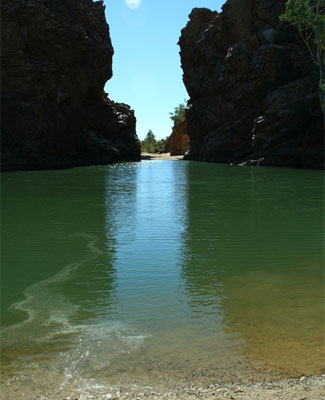
Further out, Ellery Creek Big Hole is a genuinely cold, genuinely deep permanent waterhole that holds water through the driest years and is popular for swimming from spring through autumn — the cold is real, even in the middle of summer. Ormiston Gorge, roughly 135 kilometres from Alice, is the most dramatic single feature on Namatjira Drive: a wide, curling amphitheatre of red rock around a deep permanent pool, with the Ormiston Pound circuit walk climbing up and over the ridge for a half–day loop that most fit walkers can manage. Push on past Glen Helen and you reach Redbank Gorge, the narrowest and coldest of the lot — the walk in scrambles over boulders to a slot barely wider than your shoulders, and swimming through it (some people float an inflatable mattress ahead of them) is the only way to see the far end. Glen Helen Gorge itself, where the Finke River cuts through the range, is broad and photogenic and worth the stop even if you go no further; check current facilities and access at Glen Helen before you rely on anything being open, as services out this way change.
The Ross Highway heads east from Alice Springs into quieter, less–visited country. Emily Gap (Anthwerrke) and Jessie Gap, both within 20 kilometres of town, are significant Arrernte caterpillar dreaming sites as well as pleasant, easy stops — treat them with the same respect you would a church or a cemetery, and stick to the marked paths. Corroboree Rock, a striking dolomite outcrop further along, was a storage and ceremonial site and again rewards a quiet ten minutes rather than a drive–by.
Trephina Gorge, about 85 kilometres out, is the pick of the East MacDonnells for most visitors — a wide, red–walled gorge with towering ghost gums, several walking tracks of varying length, and a genuinely good campground. From Trephina, a rough track continues to N'Dhala Gorge, a narrow, high–clearance 4WD–only gorge holding one of the largest concentrations of Aboriginal rock engravings in central Australia, some estimated at more than 10,000 years old. Ross River, further along the highway again, is a historic pastoral property that has long served as a gateway and staging point for exploring the eastern end of the range, including the remote Ruby Gap Nature Park beyond it, which is 4WD–only and genuinely remote.
If the gorges are the postcard, the Larapinta Trail is the reason serious walkers put central Australia on the list at all. It runs 223 kilometres along the spine of the West MacDonnells, from the Alice Springs Telegraph Station in the east to the summit of Mount Sonder (Rwetyepme) in the west, broken into twelve numbered sections ranging from an easy half–day stroll to tough, exposed ridge–walking with no shade and no water for a full day. Very few people walk it end to end in one go — most do it in stages over successive years, or book a supported multi–day section with an operator who carries water and food between camps. Independent through–walkers need to cache water in advance, and the exposed ridgelines make the trail genuinely dangerous in the heat; the standard advice, and the right advice, is to walk in the cooler months and be honest about fitness and preparation.
You do not need to walk the whole thing to get something out of it. Sections 1 to 4 out of the Telegraph Station, the walk in and out of Standley Chasm, and the climb to the saddle above Simpsons Gap are all achievable as day walks on genuine trail track without any of the logistics. At the western end, the pre–dawn climb to the summit of Mount Sonder for sunrise is a classic central Australian experience in its own right, walked by plenty of people with no intention of doing the rest of the trail. Current track notes, water points and seasonal closures are maintained by Parks and Wildlife Commission NT and are worth reading properly before you commit to anything beyond a day walk.
It is impossible to spend time in the MacDonnells without the name Albert Namatjira coming up, and it should. Namatjira was a Western Arrernte man from the Lutheran mission at Hermannsburg (Ntaria), on the western edge of this same range, who taught himself a European watercolour technique in the 1930s and turned it on the ghost gums, ochre cliffs and blue distances of his own country with a precision that had never been applied to this landscape before. His paintings of the MacDonnells sold out exhibitions in Melbourne and Sydney in the 1940s and made him, by some distance, the most famous Aboriginal Australian of his generation. In 1957 he became the first Aboriginal Australian granted citizenship, a status that came with a bitter irony — it gave him the legal right to buy alcohol while his own community, under the discriminatory laws of the day, still did not have that right, and a conviction tied to sharing alcohol with relatives contributed to his early death in 1959. Driving Namatjira Drive today, past Hermannsburg and out to Glen Helen, it is genuinely difficult to look at the light on those cliffs and not see his paintings in it; the resemblance is not romantic exaggeration, it is just what the country looks like at the end of the day.
Namatjira Drive is sealed as far as Glen Helen, and most of the marquee West MacDonnells stops — Simpsons Gap, Standley Chasm, Ellery Creek, Ormiston, Redbank — are accessible in a standard two–wheel–drive vehicle, though the last stretch into Redbank Gorge is gravel and best taken slowly. The Ross Highway into the East MacDonnells is sealed as far as Trephina Gorge; beyond that, N'Dhala Gorge and Ruby Gap are high–clearance 4WD only, with sand and rocky creek crossings that regularly catch out two–wheel–drive hire cars. Continuing west past Glen Helen on the Mereenie Loop towards Kings Canyon requires a permit and is not recommended in a standard car.
National park campgrounds sit at Ellery Creek, Ormiston Gorge, Redbank Gorge, Trephina Gorge and Ruby Gap, all self–registration with fees payable on site or in advance, and all bring–your–own firewood and water unless stated otherwise. None are powered. Ormiston and Trephina both have basic facilities and suit a first central Australian camping trip; Redbank and Ruby Gap are quieter, harder to reach and better suited to people who already know what they are doing.
Both ranges are close enough to Alice Springs to make a day trip genuinely worthwhile, which is unusual for anything in central Australia. Simpsons Gap is 18 kilometres from town; Standley Chasm around 50; Ellery Creek about 90; Ormiston Gorge 135; and Redbank Gorge and Glen Helen sit at 130 to 160 kilometres. On the eastern side, Emily and Jessie Gaps are inside 20 kilometres, Corroboree Rock around 45, Trephina Gorge 85 and N'Dhala Gorge a further rough 10 kilometres beyond that. Realistically, the West MacDonnells as far as Glen Helen is a full day; the East MacDonnells to Trephina Gorge is a comfortable half to full day. Alice Springs has the airport, the car and 4WD hire, and the fuel and supplies you will want before heading out — there is very little of either once you leave town, so fill up and pack water before you go.
The cooler months, roughly April to September, are the right window for almost everything except swimming. Days sit in the low to mid–20s, nights can drop below freezing at higher points along the range, and this is by far the best stretch for walking the Larapinta Trail or tackling the Ormiston Pound circuit without the heat working against you. Check current conditions and any fire danger or trail closures through the Parks and Wildlife Commission NT website and keep an eye on the Bureau of Meteorology forecast for Alice Springs before any multi–day walk, since central Australian weather can turn sharply even in winter.
The waterholes are best from around September through the start of the wet season build–up in November, and again in cooler March. The water stays cold year–round, spring–fed and deeply shaded, but the air around it is far more pleasant once summer's worst has passed. Summer itself, December through February, is genuinely hard going — 40–degree days are common, the Larapinta Trail is not recommended for through–walking, and even short walks between gaps should be done at first light.
The MacDonnells reward slowness in a way a lot of central Australian country does not. Saskia's clearest memory of the trip was not a single famous gorge but an ordinary late afternoon at Ellery Creek Big Hole, alone, watching a pair of ringneck parrots come down to drink at the shallow end while the last direct sun crawled up the far cliff face and turned it the exact burnt orange that shows up in every Namatjira painting anyone has ever seen. It is easy to tick off Simpsons Gap and Standley Chasm on a single day trip from Alice Springs and feel like you have done the MacDonnells. You have not, quite. Tjoritja rewards the extra two or three days — a section of the Larapinta Trail, a night at Trephina Gorge, the rough track out to N'Dhala — and it is that extra effort, more than any single view, that explains why people keep coming back to a range most Australians can only place somewhere vaguely near Uluru on a map.
Live forecast from Open-Meteo. Updated each time the page loads.
Based on 30 years of weather data. Sweet spot: May, Jul, Aug — mild temperatures, low rainfall and plenty of sun. Avoid Jan, Feb if you can — typically the wettest or hottest stretch of the year.
Points of interest within 25 km, pulled from OpenStreetMap. Distances are straight-line; check road access before heading out.
Real road distance and driving time to other destinations in the state. Click through for fuel estimates, suggested overnight stops, and tours along the way.


![Heavitree Gap Outback Lodge [Aurora]](https://nttravel.com.au/wp-content/uploads/2022/03/big_heavitree-gap-outback-lodge-aurora.jpg)